

Outdoor enthusiasts seeking hiking adventures in Hot Springs National Park and surrounding areas, from beginners to experienced trail runners.
Why Hot Springs is a Hiker’s Paradise
Hot Springs National Park sits smack in the middle of downtown Hot Springs, Arkansas. And that’s the weird, wonderful thing about it—you can walk from historic Bathhouse Row to serious mountain trails in about five minutes.
It’s the smallest national park in the system. But size doesn’t matter here. Within the park’s 5,500 acres, you’ve got 26 miles of trails threading through the Zigzag Mountains, plus connections to the broader Ouachita National Forest network. That’s another 700,000 acres if you’re counting.
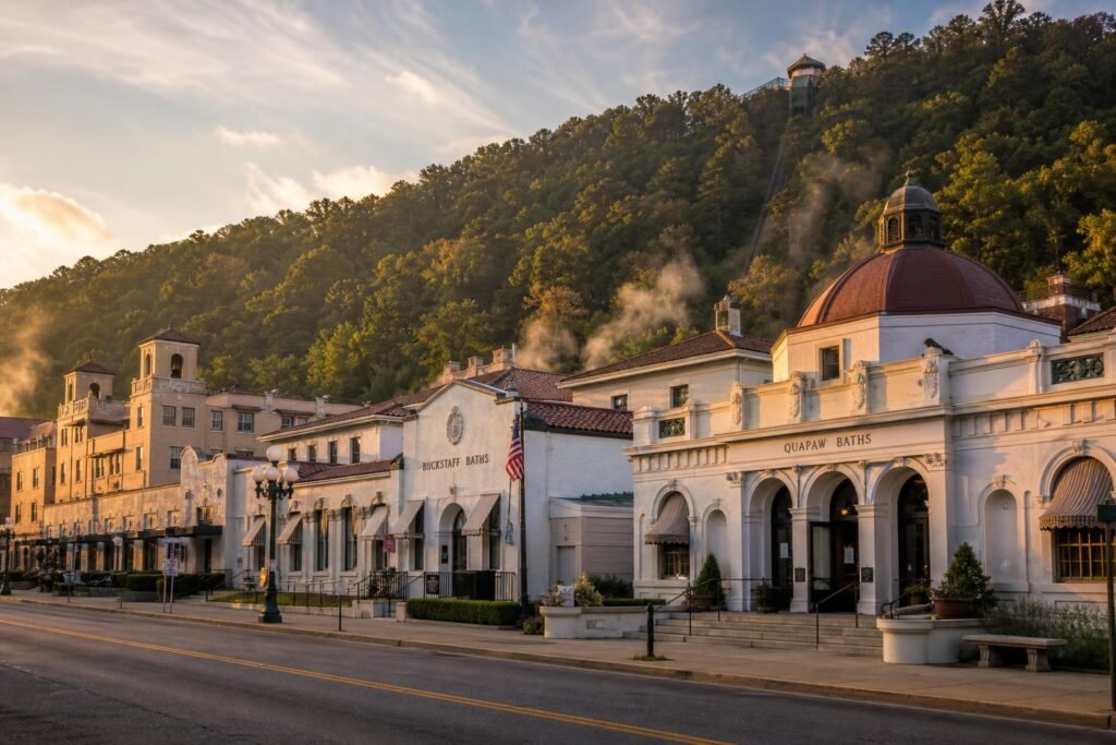
Historic Spanish Renaissance bathhouses line Central Avenue with the forested slopes of Hot Springs Mountain rising directly behind them, steam still visible from thermal springs.
The trails range from paved quarter-milers to rocky scrambles that’ll test your ankles. Most climb—because you’re in the Ouachitas, which are more like wrinkled hills than proper mountains, topping out around 1,400 feet. But the elevation gain is real. Expect your calves to remember it.
Spring (March through May) is primo. Dogwoods bloom white against the oaks, temperatures sit in the 60s and 70s, and the creeks actually have water. Fall’s second-best, with October bringing those rusty Ouachita oak colors. Summer is hot and sticky—we’re talking 90s with humidity—but the tree cover helps. I’ve hiked here in January wearing just a long-sleeve; winters are mild.
What makes these trails special isn’t drama. No waterfalls (mostly), no alpine lakes, no bears. It’s the layers. You’re walking through a national park that’s been a destination since the 1830s, when people came for the thermal waters. The trails pass stone shelters built by the Civilian Conservation Corps in the 1930s. You’ll hit overlooks where you can see both Lake Hamilton and the city below. And because it’s Arkansas, you might have a whole mountain to yourself on a Tuesday.
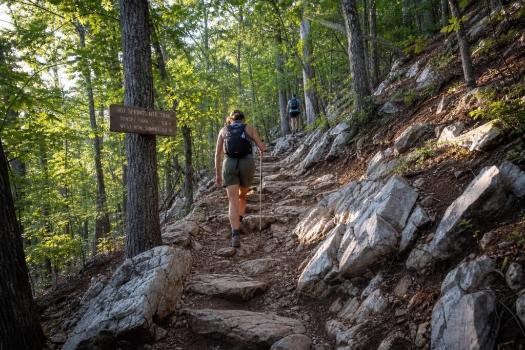
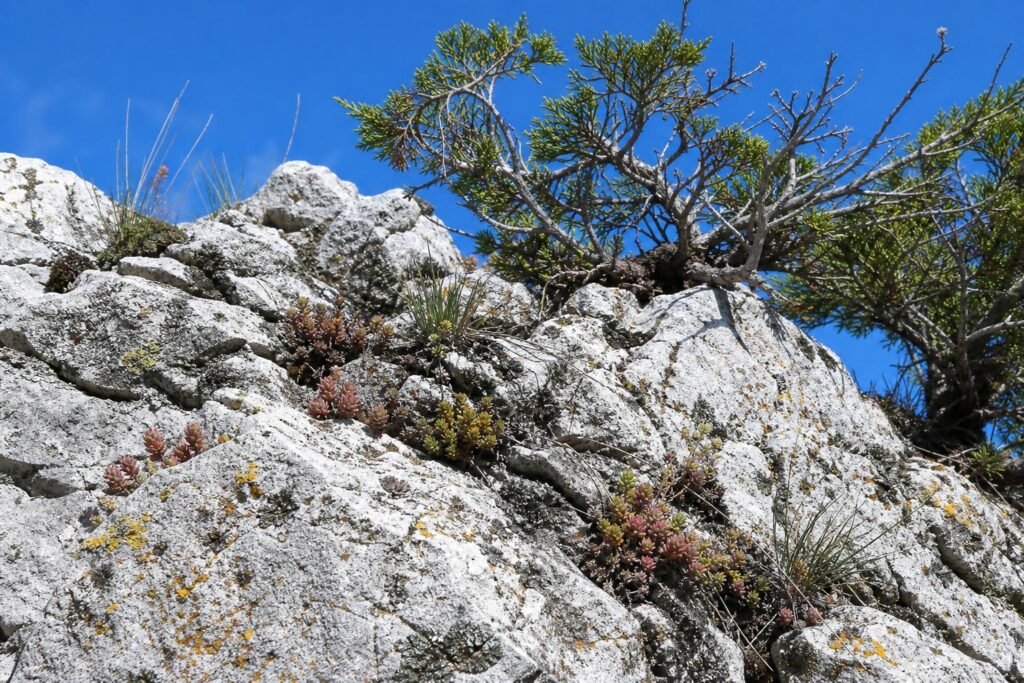
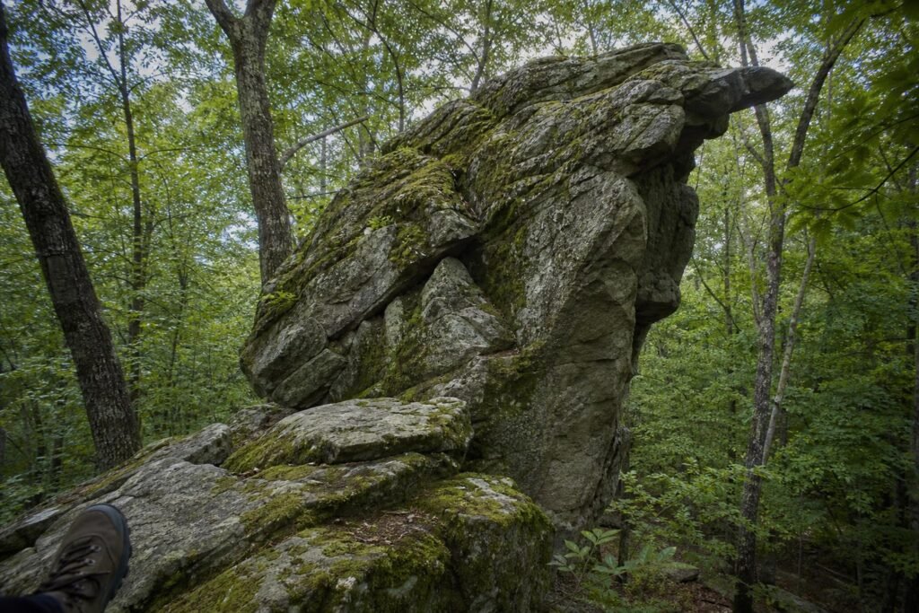
The rock underfoot is novaculite—a super-hard flint that Native Americans quarried for tools. It makes for grippy, sometimes sharp trails. Bring decent shoes.
Hot Springs National Park Trails: The Mountain Tower Circuit
Hot Springs Mountain Trail is the main artery. It starts behind Fordyce Bathhouse on Central Avenue—literally downtown—and climbs 1.4 miles to the summit. That’s Hot Springs Mountain Tower at 1,256 feet elevation. The tower itself is a 216-foot observation structure from 1983, replacing an older one. Entry is $9 for adults (as of 2024), and yeah, the views are worth it. You can see three lakes and about 140 miles on a clear day.
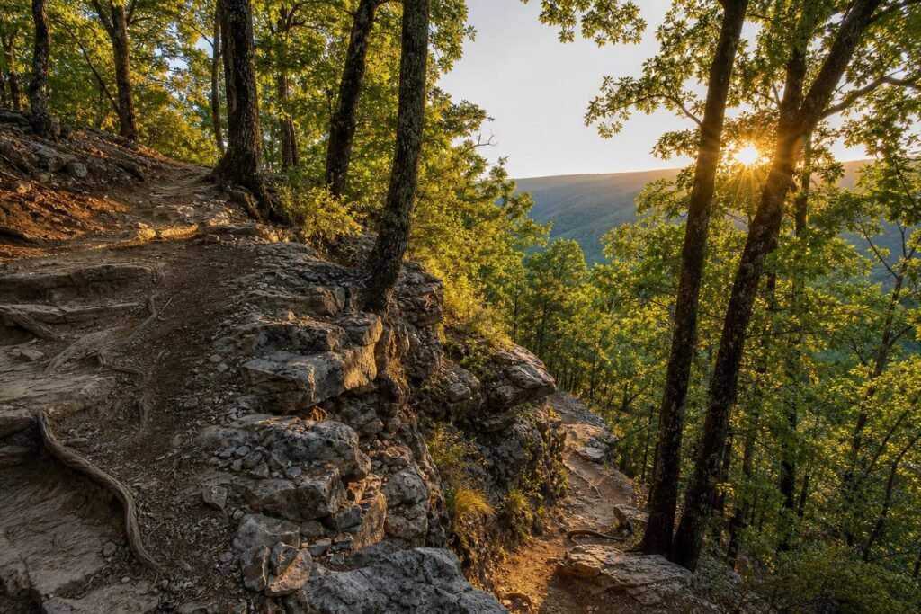
The trail gains about 700 feet. Not brutal, but steady. Switchbacks through oak-hickory forest, some rocky sections, roots. It’s the park’s busiest trail because it’s direct and delivers. You’ll pass Grand Promenade about halfway up—a historic brick walkway that connects to the lower trails.
Hikers ascending a rocky switchback flanked by white oak trees, novaculite stone jutting from the red-brown earth, dappled sunlight on the path.
Sunset Trail runs parallel and loops back. It’s 10 miles if you do the full thing, but most people combine sections. The Sunset-Hot Springs Mountain loop is about 6 miles total and gives you the tower plus long ridge walks. This is where it gets prettier—less foot traffic, more birdsong, better overlooks toward the west. I ended up using AllTrails Premium to map out the connector trails here because the park’s paper map is a bit optimistic about what’s actually signed. ↗ AllTrails Premium The offline maps saved me from backtracking twice when trail junctions weren’t marked.
There are stone shelters along Sunset—CCC-built, open-air pavilions with those distinctive stacked-rock walls. Goat Rock Shelter is the main one, about 2.5 miles in from the trailhead near Gulpha Gorge Campground. It’s a good lunch spot with views south.
Peak Trail is the steeper option. Just under a mile, but it goes straight up—600 feet in 0.8 miles. Starts at the same trailhead as Hot Springs Mountain Trail but veers left. Less scenic, more workout. Trail runners love it. If your knees are iffy, skip it.
Music Mountain Trail connects the system to Gulpha Gorge Campground on the eastern edge. It’s less traveled, which means quieter, but also means more deadfall and overgrowth in sections. Good for a change of pace if you’re staying a few days.
The trails are well-maintained but rocky. The novaculite doesn’t erode much, so you’re stepping on and around chunks constantly. Trekking poles help on descents. Most junctions are marked, but not all—download a map or screenshot the trail network before you go. Cell service is spotty once you’re on the ridges.
Winter hiking here is underrated. The leaves are down, so you actually see the topography and the lake views you’d miss in summer. And there’s almost nobody out there.
Lake Ouachita Vista Trail: Arkansas’s Premier Backpacking Experience
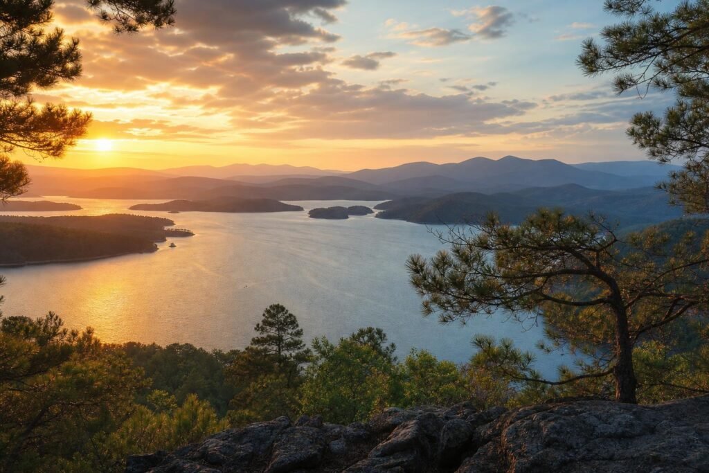
The Lake Ouachita Vista Trail doesn’t mess around. Forty miles of ridge-running singletrack above Arkansas’s clearest lake, with enough elevation change to remind your quads they exist.
Most people hit the western sections as day hikes. The Shangri-La access point near Denby Bay gets you onto the trail without committing to the full monster. You’ll climb through oak-hickory forest for about twenty minutes before the first lake vista opens up—worth every huffing breath.
Expansive lake view through pine branches with distant Ouachita Mountains layered in blue-gray haze
The trail runs the north shore ridgeline from Hickory Nut Mountain to the Blakely Mountain Dam. Elevation swings between 600 and 1,000 feet constantly. Nothing crazy steep, but the cumulative gain over distance will humble you.
For backpackers, the primitive campsites perch on knobs with lake views. Sites 3 and 7 are money—flat spots under pines with water access down steep side trails. I ended up using Sawyer’s gravity filter system on my last trip because hauling lake water up 200 vertical feet gets old fast. ↗ Sawyer Products
The middle section between Twin Creeks and Brady Mountain is the wildest. You’ll go hours without seeing anyone. Spring brings redbuds and dogwoods lighting up the understory. Fall gives you that impossible Arkansas color—scarlet sumac against yellow hickory with the blue lake backdrop.
Day hikers should know the access points. Iron Mountain (west end) and Blakely Dam (east end) are obvious. But Brady Mountain, Winding Stairs, and Hickory Nut all offer 4-6 mile out-and-back options that hit the best views without the full commitment.
Water is the planning factor. The lake is right there, but often 300 feet below you. Carry more than you think. In summer, I’m talking 3 liters minimum for a day section.
The trail surface is mostly packed dirt and rock, technical enough to keep you honest but not ankle-breaker territory. Roots and loose stones on descents. Trekking poles help, especially with a loaded pack.
Narrow dirt path winding between lichen-covered boulders with glimpses of blue water through trees
Winter hiking here is underrated. No bugs, no heat, and the bare trees open up views you miss in summer. Just watch for ice on north-facing slopes after cold snaps.
The full thru-hike takes most people 3-4 days. You could push it in two if you’re fit and slightly masochistic. But why rush? The whole point is those sunrise camps above the lake, watching mist burn off the coves.
Trail maintenance is decent but not obsessive. Expect some blowdowns in spring, especially after ice storms. The Ouachita National Forest Service and volunteers keep it manageable, but this isn’t a manicured rail-trail.
Navigation is straightforward—white blazes the whole way. But the trail does dip into hollows and wrap around ridges enough that a map helps. The Lake Ouachita Vista Trail Association publishes a good one.
Gulpha Gorge and Cedar Glades Loop: Waterfall and Wildflower Trails
Gulpha Gorge Campground sits in Hot Springs National Park proper, and the trail network here punches way above its mileage.
The Gulpha Gorge Trail itself is 1.2 miles one-way to Hot Springs Mountain. Starts at the campground amphitheater and climbs through a ravine that actually feels wild despite being ten minutes from downtown. You’ll cross Gulpha Creek four times on wooden bridges.
In February and March after rain, a seasonal waterfall spills down the rock face about halfway up. Nothing dramatic—maybe fifteen feet—but it’s a pretty spot with ferns and moss doing their thing.
The elevation gain is around 500 feet, steady but never brutal. The trail dumps you out on Hot Springs Mountain Drive near the observation tower. Most people loop back down the road or arrange a shuttle.
But the real gem is the Cedar Glades Trail. Two miles of the most ecologically interesting hiking in the park. The glades themselves are exposed rock barrens where shallow soil and full sun create a mini-desert ecosystem.
Weathered white rock outcrop dotted with tiny succulents, lichen, and stunted cedars against blue sky
Spring wildflowers here are ridiculous. Prickly pear cactus blooms yellow in May. Fame flower, glade coneflower, and little bluestem grass turn the rocks into a palette. It’s genuinely weird and beautiful.
The trail loops through forest, then opens onto these bald rock areas, then back into trees. The contrast is what makes it. You’re in shady oak forest, then suddenly on a sun-blasted moonscape with views over the valley.
Access is from Goat Rock or Gulpha Gorge. The full Cedar Glades Loop connects both and runs about 4 miles total with maybe 600 feet of elevation. Moderate by any measure—enough to feel like exercise without destroying your knees.
Footing on the glades themselves requires attention. The rock can be slick when wet, and the trail isn’t always obvious crossing the balds. Look for cairns. In summer, the exposed sections bake. Bring a hat and start early.
Weathered brown trail marker post with multiple directional signs surrounded by fallen leaves and green undergrowth
The loop works either direction, but I prefer counterclockwise from Gulpha Gorge. You get the waterfall and creek crossings first while you’re fresh, then the glades section when you’ve warmed up.
Combine this with the Dead Chief Trail if you want more mileage. That adds another 2 miles and connects to the Sunset Trail system. You can easily piece together a 6-8 mile day hitting multiple ecosystems.
These trails see decent traffic but nothing crazy. Weekday mornings you might have the glades to yourself. Weekends bring families and dog walkers, but it never feels crowded like the more famous park trails.
The National Park Service maintains everything well. Clear signage, solid bridges, benches at viewpoints. It’s a good introduction to Ouachita Mountain ecology without the commitment of the longer backcountry trails.
West Mountain Trails: Challenging Peaks with Panoramic Rewards
West Mountain doesn’t mess around. The loop system here—about 5.5 miles if you do the full circuit—gains 800 feet and throws some genuinely technical scrambles at you. I’ve watched confident hikers turn around at the Balanced Rock section.
Start from the West Mountain trailhead on Whittington Avenue (there’s parking for maybe 15 cars, fills up by 9am on weekends). The trail climbs immediately through oak and hickory forest. Your calves will know about it.
Steep switchback cutting through oak forest with dappled sunlight hitting exposed tree roots and limestone ledges jutting from the trail edge
About a mile in, you hit Balanced Rock—a legitimate 20-foot boulder perched on what looks like a stone pedestal. The trail gets rocky here. Not “watch your step” rocky. More like “use your hands and consider your life choices” rocky. It’s short, maybe 50 yards of scrambling, but enough to spike your heart rate.
The summit sits at 1,405 feet. On clear days you see the Ouachita Mountains rolling west and downtown Hot Springs below. I usually carry a small pair of binoculars for this—you can pick out individual buildings and watch the steam rising from Bathhouse Row.
Most experienced hikers here use trail runners with aggressive lugs rather than boots. The terrain is too varied—smooth granite slabs, loose gravel, exposed roots—for any one shoe to excel. I switched to Salomon Speedcross 5s after sliding on a granite section near the summit, and the difference was immediate. ↗ Salomon Speedcross 5
Whittington Avenue Trail connects about halfway through if you want to bail early or extend your hike. It’s an old roadbed, much easier footing, winds down through pine forest to Fountain Street. Adds 1.2 miles but saves your knees on the descent.
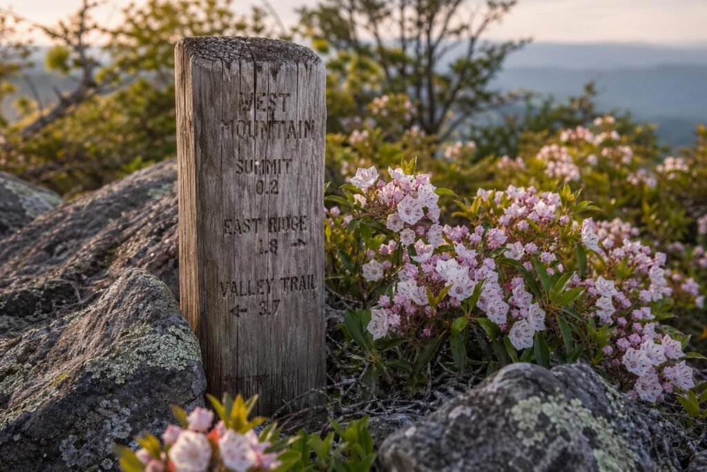
Weathered wooden trail marker post with carved mileage surrounded by blooming mountain laurel and lichen-covered rocks
Water sources: none. Carry two liters minimum. I’ve seen people bonk hard on the final climb because they underestimated how exposed and sun-baked the upper sections get.
The full loop takes 2.5-3 hours at a moderate pace. Counterclockwise is standard—saves the best views for when you’re tired and need motivation. Clockwise front-loads the hardest climbing, which some people prefer.
Wildlife: I’ve startled deer, seen turkey vultures riding thermals from the summit, and once watched a black rat snake that was easily five feet long cross the trail near Balanced Rock. Snakes are common in rocky sections, especially April through October.
North Mountain and Goat Rock Trail: Hidden Gems for Solitude Seekers
North Mountain sees maybe 20% of the foot traffic that Sunset and West Mountain get. I’ve hiked the 3.8-mile loop on Saturday mornings and passed two people total.
The trailhead is easy to miss—it’s on Fountain Street near the North Mountain overlook parking area, marked by a small wooden sign that’s seen better days. No facilities, no water fountain. Just forest.
This trail stays in tree cover for most of its length. Oak, hickory, and shortleaf pine create a canopy that keeps things about 10 degrees cooler than the exposed trails. In July, that matters.
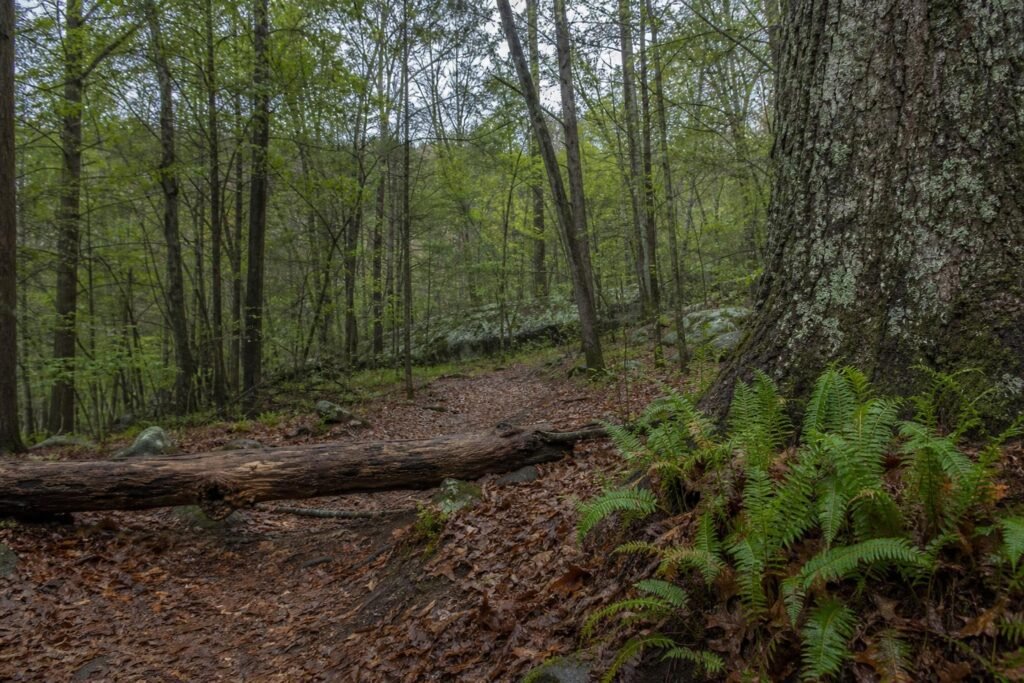
Dense forest trail with thick carpet of brown leaves, fallen log crossing path, and green ferns growing from base of massive oak tree
Goat Rock sits about 1.5 miles in—a granite outcrop that juts maybe 40 feet above the surrounding forest. The rock face has natural handholds worn smooth by decades of climbers. It’s not technical if you take the trail that wraps around to the back, but scrambling the face is more fun. Views are limited, mostly treetops, but the rock itself is the draw. Weathered, fractured granite with quartz veins running through it like lightning.
The trail connects to the Dogwood Trail around mile 2.3, which eventually links to Sunset Trail if you’re ambitious. Most people just loop back. Total elevation gain is modest, maybe 400 feet, but it comes in short punchy sections rather than sustained climbing.
I’ve seen the best wildflowers here in mid-April. Bloodroot, trillium, and wild azalea grow thick in the understory. By June it’s mostly green, and by September you’re walking through crunchy leaf litter that announces your presence to every creature within 100 yards.
The solitude is the selling point. If you want to hear yourself think, or listen to bird calls without earbuds in, this is your trail. I’ve eaten lunch on Goat Rock with nothing but wind in the pines and the occasional woodpecker for company.
Angular granite outcrop rising from forest floor with patches of green moss, hiker’s boot visible on lower ledge, trees framing background
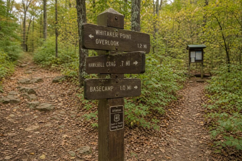
One technical note: the trail markings are inconsistent. White blazes appear every 50 feet in some sections, then vanish for a quarter mile. Download an offline map or pay attention at junctions. I’ve watched people confidently take the wrong fork and add an hour to their hike.
The descent back to Fountain Street is gradual, following an old logging road for the final half mile. Easy on the knees, slightly monotonous, but after Goat Rock you’ve earned boring.
Essential Trail Tips: What to Pack and When to Go
Late September through November is when I go back to Hot Springs. The humidity finally breaks, temps sit in the 60s and 70s, and the dogwoods turn that burnt orange color that looks incredible against the gray rock faces on Sunset Trail.
Spring’s pretty good too—March through May—but you’re gambling with afternoon thunderstorms that can make those steep sections on Goat Rock muddy and treacherous. I’ve slipped on my ass more times than I’ll admit on wet shale.
Summer? Only if you start by 7 AM. By 10, the humidity makes it feel like you’re hiking through soup, and the exposed sections on Hot Springs Mountain Trail become brutal. I watched a guy from Michigan nearly pass out up there in July because he brought one water bottle for a four-hour hike.
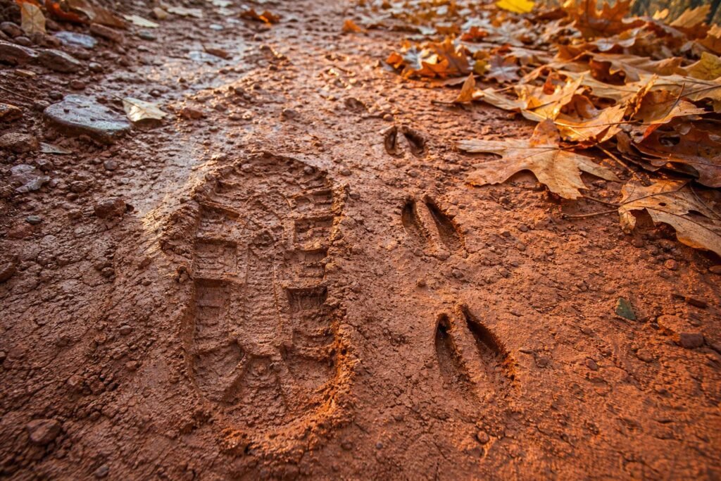
Worn boot print in red clay mud next to fresh deer tracks, both heading uphill toward scattered oak leaves
Water’s the main thing people mess up here. Only West Mountain Trail has a reliable water source (a spring about halfway up the north side), and even that runs low by August. I carry 3 liters minimum for anything over 5 miles, 4 liters in summer. Yeah, it’s heavy. Dehydration’s heavier.
The rock gardens on Balanced Rock Trail will destroy mesh running shoes in about three hikes. I learned this the expensive way. You want something with a reinforced toe box and good ankle support—the trails here are technical enough that a rolled ankle is a real possibility, especially on Dead Chief.
Permits aren’t required for anything in the park, which still surprises me. You can just show up and hike. Parking fills up at the Gulpha Gorge trailhead by 9 AM on weekends during fall color season though, so factor that in.
Ticks are relentless from April through October. I pull 2-3 off my legs after every hike if I don’t spray down first. Permethrin on your clothes, DEET on exposed skin. I don’t love chemicals either, but Lyme disease is worse.
Trail conditions vary wildly even within the same system. The National Recreation Trails (Sunset, Goat Rock) get maintained regularly. Some of the older historic paths like Dead Chief? You’re basically bushwhacking in places where the trail’s overgrown. Check the Hot Springs National Park website for current conditions—they actually update it, unlike some parks.
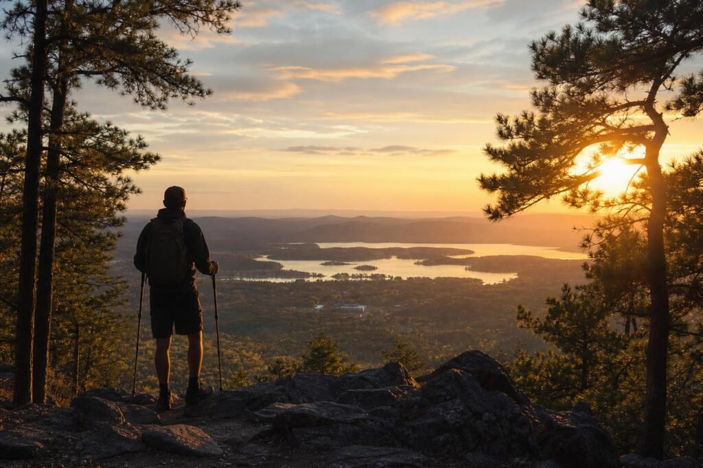
Single hiker silhouette looking out over Lake Hamilton through gap in pine trees, backpack and trekking poles visible
Lightning’s no joke on the exposed summits. If you hear thunder, you’re already too late to be up there safely. I’ve had to bail off Hot Springs Mountain twice when storms rolled in faster than predicted. The trees here are tall, but they’re not protection—they’re lightning rods.
Bring a basic first aid kit with blister supplies, even on short hikes. The descents here are steep enough that your toes slam forward in your boots, and I’ve seen people limping back with bloody socks more times than you’d think. Leukotape before you start if you’re blister-prone.
Beyond the Trails: Combining Hiking with Hot Springs Experiences
The whole point of Hot Springs is that you get to feel like a badass on the trail, then soak away the soreness in 143-degree thermal water an hour later. It’s the perfect combination if you time it right.
My standard weekend: sunrise hike Friday morning (Sunset Trail if I’m feeling ambitious, Fordyce Estate if I’m not), then hit Bathhouse Row by noon. Quapaw Baths is the move—it’s the only one that feels like an actual spa instead of a museum. Four pools at different temps, and you can rotate through them while your quads slowly remember how to function.
The historic bathhouses are worth seeing even if you don’t soak. Fordyce Bathhouse is now the park visitor center, and it’s this absurd 1915 time capsule with stained glass, marble fountains, and old hydrotherapy equipment that looks like medieval torture devices. Free to walk through, 20 minutes max.
Saturday morning’s when I do the longer hikes—West Mountain or the full Sunset/Goat Rock loop. By early afternoon I’m back downtown, and this is key: Superior Bathhouse Brewery is the only place in America that brews beer with thermal spring water. Is it a gimmick? Absolutely. Does the Klondike Blonde taste fantastic after an 8-mile hike? Also absolutely.
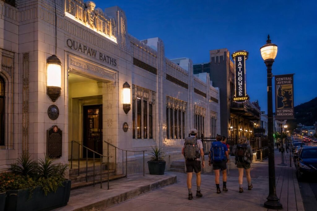
Art deco bathhouse facade lit up at dusk, with hikers in boots and daypacks walking past toward brewery entrance
Food downtown’s better than it should be for a town of 38,000. The Pancake Shop has been there since 1940 and serves exactly what you need before a big hike—cheap, massive, fast. For dinner, I go to Deluca’s Pizzeria (on Higdon Ferry Road, not downtown) where they know what a proper crust is.
If you’ve got kids or non-hikers in your group, the Gangster Museum is legitimately interesting. Hot Springs was a major mob vacation spot in the ’30s—Al Capone, Lucky Luciano, all those guys came here to hide out and soak. Takes about an hour to go through.
The Arlington Resort Hotel is this massive 1920s place right on Bathhouse Row that’s worth staying at once just for the experience. Rooms are dated but clean, and you can access their thermal baths and pools. Weekend rates run about $150, which is reasonable for a historic property this size.

Weathered bronze fountain spout on Central Avenue, steam rising from hot spring water, person filling metal water bottle
A realistic weekend itinerary: Drive in Friday evening, early dinner downtown, twilight walk along the Grand Promenade (the brick pathway behind the bathhouses—1.4 miles, dead flat, nice views). Saturday sunrise on the trails, afternoon soak and brewery, evening in town. Sunday morning relaxed hike on Fordyce Estate Trail, then home by lunch.
Lake Ouachita’s 30 minutes west if you want swimming that doesn’t involve thermal water that’ll poach you like an egg. It’s one of the cleanest lakes in the U.S., and there are primitive hiking trails around the shoreline that see almost no traffic.
Don’t try to cram too much in. I made that mistake my first trip—hiked 15 miles, toured every bathhouse, drove out to the lake, came home exhausted and sore instead of refreshed. Pick 1-2 good hikes, soak properly, eat well. That’s the whole formula.